Speakers 2024
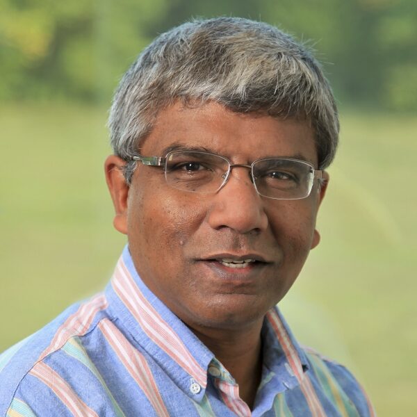
Mr. Valentine Anantharaj, Senior Computational Climate Scientist, Oak Ridge National Laboratory
Valentine Anantharaj is a Senior Computational Climate Scientist with the Oak Ridge Leadership Computing Facility (OLCF) at the National Center for Computational Sciences (NCCS). His current role at OLCF involves managing multi-petabytes of data from earth observations and earth system simulations and preparing them for analysis and applications. Recently, he also served in a technical leadership role, as a Joint Group Lead for the DOE Energy Exascale Earth System Modeling (E3SM) project. He has diverse professional experience in the broad areas of computational sciences & engineering, machine learning, scientific data management, applications & decision-support frameworks for weather & climate sciences. His current focus is on advancing the leadership scale climate simulations and the development of AI foundation models for climate and atmospheric science research and applications, including digital twins for satellite earth observations.

Dr. Assaf Anyamba, Distinguished R&D Staff Member and Group Lead of Remote Sensing Group, Oak Ridge National Laboratory
Dr. Assaf Anyamba is a Distinguished R&D Staff Member and Group Lead of Remote Sensing, Geographic Data Science Section in the Geospatial Science and Human Security Division, National Security Sciences Directorate at Oak Ridge National Laboratory (ORNL), Oak Ridge, Tennessee.
His research is on understanding the land surface response to climate variability primarily through satellite-derived vegetation index time series measurements and the application of various satellite climate measurements to study ecologically coupled diseases and agricultural monitoring. His research and applications have supported operational programs of various federal government agencies including the Department of Defense - Global Emerging Infections Surveillance, the United States Department of Agriculture - Foreign Agricultural Service and Center for Medical, Agricultural and Veterinary Entomology, Defense Threat Reduction Agency, Food and Drug Administration among others. He has been involved in various cross-cutting forums including the National Academy of Sciences/ National Academy of Medicine (NAM): Vector-borne Diseases, Human Health and Climate Change, The Brookings Institution, and The Rockefeller Foundation 17 Rooms Initiative on Transforming National and Global Epidemic Intelligence Systems, World Organization for Animal Health/ Office International des Epizooties (WAOH), World Health Organization (WHO) - Global Outbreak Alert and Response Network (GOARN) on Rift Valley fever, Food and Agricultural Organization of the United Nations (FAO) - Emergency Prevention System for Transboundary Animal and Plant Pests and Diseases (EMPRES) among others. In addition, his work has been featured in various media outlets including National Public Radio (NPR) – Morning Edition, Science Friday, British Broadcasting Corporation (BBC) – Science in Action, Voice of America (VoA2q), in print and the Netflix, Documentary Connected: Clouds, The Hidden Science of Everything. He has over 80 peer-reviewed publications in various interdisciplinary journals.
Dr. Anyamba received his Ph.D. in Geography from Clark University, Worcester, Massachusetts. He has an MA from Ohio University, Athens, Ohio, and a BA in Geography
and Economics from Kenyatta University, Kenya.
Dr. Samantha T. Arundel, Director, Center of Excellence for Geospatial Information Science, U.S. Geological Survey
Dr. Samantha T. Arundel is the director of the Center of Excellence for Geospatial Information Science (CEGIS) at the U.S. Geological Survey. She also fills the role currently of Senior Science Advisor to the director of the USGS National Geospatial Program. Her research focuses on GeoAI, particularly automating terrain and other map feature detection and recognition and using GeoAI to integrate spatial analyses. She headed the development team in the automation of the 3D Elevation Program as it superseded the National Elevation Dataset. Sam has a special interest in operationalizing GeoAI research. Before joining the USGS in 2009, Dr. Arundel was an assistant and then associate professor of geography at Northern Arizona University in Flagstaff. Sam has a Ph.D. in Geography from Arizona State University.

Ms. Katie Baynes, Earth Data Officer for Earth Science Division, National Aeronautics and Space Administration Headquarters
Katie Baynes serves as Earth Data Officer for NASA's Earth Science Division at HQ and previously held the position of Deputy Chief Science Data Officer for the Science Mission Directorate. Before joining NASA HQ, she was the Systems Architect for NASA's Earth Observing System Data and Information System (EOSDIS).
Katie has dedicated the past decade to the development of large-scale Earth Science data processing, visualization, ingestion, archival, and distribution systems. In addition, she has been actively engaged in Earth science metadata curation and standards and cloud computing communities. She's passionate about fostering community development models and advancing open-source science, with a focus on making software, data, and science more usable, transparent, and accessible to all.
Katie resides outside Washington, DC, with her husband and two children.
Dr. Budhendra Bhaduri, Corporate Research Fellow and the Director of Science, Programs, and Partnerships for National Security Sciences, Oak Ridge National Laboratory
Dr. Budhendra “Budhu’ Bhaduri is a Corporate Research Fellow and the director of science, programs, and partnerships for national security sciences at Oak Ridge National Laboratory (ORNL). In that capacity he is responsible for crosscutting science strategy and program development focusing on novel implementation of geospatial science and technology across energy, environment, and national security missions across the U.S. Government agencies including the Department of Energy, the Department of Defense, and the Department of Homeland Security.
Dr. Bhaduri is a Fellow of the American Association for the Advancement of Science (AAAS), the American Association of Geographers (AAG), and has served on the Geographical and Geospatial Sciences Committee of the National Academy of Sciences. He is a founding member of the U.S. Department of Energy’s Geospatial Sciences Steering Committee and is a recipient of the Department’s Outstanding Mentor Award for his dedicated service to the department for developing future workforce for the nation.
Dr. Bhaduri received his Ph.D. in Earth & Atmospheric Sciences from Purdue University. He has a MS from Kent State University, and a M.Sc. and a B.Sc. from University of Calcutta, India.

Dr. Sambit Bhattacharya, Full Professor of Computer Science, Fayetteville State University
Dr. Sambit Bhattacharya is a Full Professor of Computer Science at Fayetteville State University, North Carolina, USA. He is experienced in developing and executing use-inspired research in Artificial Intelligence and Machine Learning (AIML) with a broad range of techniques and applications, and with multidisciplinary teams. He has more than 60 peer reviewed publications and has delivered 50+ oral presentations, including keynote lectures at conferences. Dr. Bhattacharya works on research in the applications of AIML to geospatial intelligence, computer vision with synthetic data for target recognition, efficiency and latency reducing AIML inference for edge computing. He directs the Intelligent Systems Lab (ISL) at Fayetteville State University which hosts research and houses resources like robotics equipment, and computing machines for AIML research. He is Principal Investigator of projects funded by multiple agencies including the National Science Foundation (NSF), the US Department of Defense (DoD), and NASA. These funded projects support students and faculty, enhance funded collaboration with researchers from centers and labs like the Jet Propulsion Laboratory, and with businesses including small businesses which are owned by minorities and disabled veterans. Dr. Bhattacharya has an MS and a PhD in Computer Science and Engineering from the State University of New York at Buffalo.

Dr. Sid Ahmed Boukabara, Senior Program Scientist for Strategy, National Aeronautics and Space Administration
Dr. Sid Ahmed Boukabara currently serves as the senior program scientist for strategy of the Earth Science Division (ESD) within NASA’s Science Mission Directorate (SMD). He has been a member of the ESD leadership team since April 2023, supporting the Director and Deputy Director in framing and executing NASA Earth Science strategy and the multi-agency collaboration efforts. As senior program scientist, he is also responsible for facilitating strategic science initiatives that require coordination across multiple elements of ESD encompassing technology, flights, data systems, research and earth action.
Dr Boukabara has 29 years of cumulated experience in satellite remote sensing design, research and related applications. Eighteen of those years were spent with the National Oceanic and Atmospheric Administration (NOAA) where he was the principal scientist at the Office of Systems Architecture and Advanced Planning, supporting the effort to plan, design and evolve the Nation's operational space and ground architectures of the future. In addition, he has held numerous positions including that of deputy director and acting director for the multi-agency U.S. Joint Center for Satellite Data Assimilation as well as acting deputy director of the Center for Satellite Applications and Research (STAR).
Ms. Laura Carriere, High-Performance Computing Lead, NASA Center for Climate Simulation, National Aeronautics and Space Administration
Ms. Laura Carriere is the High-Performance Computing (HPC) Lead at the NASA Center for Climate Simulation (NCCS). Her responsibilities include ensuring that scientists have access to the compute resources they need by managing the details required to keep a supercomputer, a private cloud, centralized storage, public cloud access, and the backend services up and running. Before that she worked as a Technical Project Manager for the NCCS for almost a decade. She managed projects ranging from science data processing, web visualization, data analytics, HPC benchmarking, and a centralized storage project. Previously, Laura worked as a System Administrator for other NASA projects and various universities.
Dr. Carter Christopher, Section Head for Human Dynamics R&D, Oak Ridge National Laboratory
Dr. Carter Christopher is Section Head for Human Dynamics R&D at Oak Ridge National Lab. Dr. Christopher leads five research groups applying novel geospatial science techniques to solve global-scale challenges in Energy Security and National Security. He is also the Principal Investigator for a diverse portfolio of geospatial science projects at the intersection of HPC, GeoAI, and human dynamics. Prior to joining ORNL, Dr. Christopher was Head of Geospatial at an aerospace start-up, and he had a distinguished 12-year career in the US Intelligence Community. He spent more than 10 years at the National Geospatial-Intelligence Agency where he led a range of geospatial modernization programs, including geospatial AI/ML and cloud modernization efforts. Dr. Christopher closed his federal career at the State Department as Deputy to the Geographer of the United States, where he helped stand up the Department’s enterprise GIS. He has a PhD in Earth Systems and Geoinformation Science.

Mr. Mark Cygan, Director, National Mapping Soluions
Mark has worked in GIS and mapping since 1984, and has been Esri’s Director, National Mapping Solutions, since 2004. He has a passion for working with National Mapping, Maritime, Aviation and Geospatial Authorities to help them be successful. Mark previously worked with these same organizations for nearly 10 years as a Senior Consultant and Project Manager in Esri’s Professional Services. Prior to Esri, Mark was on the management team at NAVTEQ (now HERE), as they were pioneering digital mapping for in-vehicle navigation, web, and mobile uses. He was also the Manager of Rand McNally & Co, California Cartographic Services, and worked at the Automobile Club of Southern California, Cartography Section, and the U.S Forest Service.
Mark is the co-Chair of the User Community of Geospatial Authorities Working Group 2 on Remote Sensing and GeoAI, which includes ethics and trust. He has been a presenter, panelist and co-organizer of events focusing on Ethics and Trust in Mapping and GIS since 2021.
Mark is actively serving as; United Nations Committee of Experts on Global Geospatial Information Management (UN-GGIM) Observer, UN-GGIM Geospatial Societies Board Member (and past Chair and currently Deputy Chair), User Community of Geospatial Authorities Executive Secretary, International Map Industry Association (IMIA) Advisory Board Member, and National Government Executive Summit @ Esri UC Steering Group Chair. Mark is the proud father of six kids and eight grandkids and enjoys exploring the world when he is not hiking in the high country of the Sierra Nevada Mountains in CA.
Dr. Ahmed Eldawy, Associate Professor in Computer Science, University of California Riverside
Dr. Ahmed Eldawy is an Associate Professor in Computer Science at the University of California Riverside. His research interests lie in the broad area of databases with a focus on big data management and spatial data processing. Ahmed led the research and development in many open source projects for big spatial data exploration and visualization including UCR-Star, an interactive repository for geospatial data with nearly four terabytes of publicly available data. He is a recipient of the highly prestigious NSF CAREER award as well as the best demo award in SIGSPATIAL 2020. His work is supported by the National Science Foundation (NSF) and the US Department of Agriculture (USDA).
Dr. Kjiersten Fagnan, Chief Informatics Officer, US Department of Energy Joint Genome Institute, Lawrence Berkeley National Laboratory
Dr. Kjiersten Fagnan began working with the Joint Genome Institute (JGI) in 2012 as a National Energy Research Scientific Computing Center (NERSC) bioinformatics computing consultant, after completing a petascale postdoctoral fellowship at NERSC and Lawrence Berkeley Laboratory’s (LBL’s) Computational Research Division. As a postdoc her research focused on stable and accurate computational methods for reacting subsurface flows and evolved into scalable methods for scientific data analysis. In 2014 Dr. Fagnan became the JGI-NERSC Engagement Lead with a focus on adapting JGI workloads to run on supercomputing hardware and worked closely with staff to understand the data-intensive nature of JGI workloads. Dr. Fagnan was appointed Chief Informatics Officer (CIO) of JGI in 2016 and in 2018 was hired to be the JGI’s Data Science and Informatics department head. Dr. Fagnan has more than ten years of experience building distributed data and computing infrastructure for the JGI and has overseen the deployment of user-focused tools like the JGI Data Portal. Dr. Fagnan is also a co-PI for the National Microbiome Data Collaborative supporting infrastructure and user-centered design efforts.

Dr. David Hall, Senior Data Scientist and Solution Architect, NVIDIA
Dr. David M. Hall is a Senior Data Scientist and Solution Architect at NVIDIA. His research focuses on applications of Artificial Intelligence for the Earth and space sciences. Previously, Dr. Hall held positions as an Assistant Professor of Research in the Computer Science Department at CU Boulder, and as a Research Scientist at the National Center for Atmospheric Research. He has a broad technical background in theoretical physics, computational fluid dynamics, remote sensing, numerical methods, weather and climate modeling, and artificial intelligence. Before joining NVIDIA, Dr. Hall spent much of the previous decade developing numerical techniques to improve the atmospheric components of the CESM and E3SM global climate models. Dr. Hall earned a PhD in Soft Condensed-Matter Physics from the University of Santa Barbara, CA and a BA in Physics from CU Boulder.
Dr. Justin Jay Hnilo, Program Manager for Data Management and Informatics, US Department of Energy, Office of Science
Dr. Justin Jay Hnilo is a Program Manager for Data Management and Informatics within the US Department of Energy (DOE), Office of Science, Biological and Environmental Research, Earth and Environmental Systems Sciences Division (EESSD). His responsibilities include initiating an infrastructure whereby EESSD’s various data forms may be readily used to accelerate Earth system science. His open source archives support all of the Coupled Model Intercomparison Project (CMIP) data dissemination efforts that support many of the ongoing climate change efforts of the United Nations Intergovernmental Panel on Climate Change (IPCC). Jay received his PhD in Atmospheric Science from the University of Alabama in Huntsville. He has worked broadly across some of the largest reanalysis and modeling efforts, initially at the Program for Climate Model Diagnostics and Intercomparison (PCMDI) at Lawrence Livermore National Laboratory (LLNL), then at National Oceanic and Atmospheric Administration’s (NOAA’s) Cooperative Institute for Climate and Satellites (CICS-NC) as a senior scientist within the National Climate Model Portal (NCMP) group. He joined DOE Headquarters eleven years ago and has overseen expansion of data archives and development of data-driven approaches for models.
Dr. Forrest M. Hoffman, Distinguished Computational Earth System Scientist and Group Lead for the Integrated Computational Earth Sciences Group, Oak Ridge National Laboratory
Forrest M. Hoffman is a Distinguished Computational Earth System Scientist and the Group Leader for the Integrated Computational Earth Sciences Group at Oak Ridge National Laboratory (ORNL). He develops and applies Earth system models (ESMs) to investigate the global carbon cycle and feedbacks between biogeochemical cycles and the climate system. He is particularly interested in applying machine learning methods to explore the interactions of terrestrial and marine ecosystems with hydrology and climate. In addition, Forrest applies data mining methods using high performance computing to problems in landscape ecology, ecosystem modeling, remote sensing, and large-scale climate data analytics. He leads development and deployment of a next generation Earth System Grid Federation (ESGF) distributed data infrastructure in the US. Forrest is also a Joint Faculty Member in the University of Tennessee’s Department of Civil & Environmental Engineering in nearby Knoxville, Tennessee, a Senior Member of the Institute of Electrical and Electronics Engineers (IEEE), and a Fellow of the American Association for the Advancement of Science (AAAS).

Dr. Hook Hua, Senior Data Scientist and Architect, Instrument Software and Science Data Systems, Jet Propulsion Laboratory / California Institute of Technology
Hook is a Senior Data Scientist and Architect at NASA's JPL where he leads innovation and development in Earth Science Data Processing Systems. He has successfully led as principal investigator, product delivery manager, and architect of research projects to infusion into flight missions. He has experience from formulation, funding capture, innovation, technology development, and infusion to missions in large-scale science data processing applying multi-cloud, HECC, and ML technologies. He led the creation of the open source HySDS, which has been infused into many Earth science missions such as NISAR, SWOT, SMAP, OCO-2, OCO-3, MAAP, and SNWG/OPERA. Hook is also the science data processing systems architect for many NASA missions including the upcoming SBG mission.
Hook has chaired/co-chair many ESDSWG and ESIP Federation working groups, served on several advisory committees, Board member of a NASA DAAC User Working Group, and was a member of the international W3C Provenance Working Group. He has also written a book chapter on large-scale hybrid science data processing.
His technical contributions to JPL and NASA earned him the 2017 AGU Charles S. Falkenberg Award for applying emerging computer science techniques and technologies to Earth science. He was also a recipient of several NASA Honor Awards and JPL Explorer Awards in the area of large-scale science data processing and infusion into NASA missions. Hook's contributions were also awarded a patent on rapid imaging and analysis for earthquakes.
Mr. Todd Johanesen, Director, Foundation GEOINT Group in the Source Operations and Management Directorate of the National Geospatial-Intelligence Agency
Mr. Todd E. Johanesen serves as Director, Foundation GEOINT Group in the Source Operations and Management Directorate (Source) of the National Geospatial-Intelligence Agency (NGA), located in Springfield, Virginia. In this capacity, he leads an organization that provides assured, timely, relevant, and accurate foundation geospatial intelligence (GEOINT) data, products, and services in support of prioritized requirements of the warfighter, our national security objectives, and Safety of Navigation
needs of the U.S. government.
Before joining Source, Mr. Johanesen served as Director, Office of Special Programs in the Analysis Directorate (2018-2022). In this position, he was responsible for all aspects of sensitive GEOINT activities in support of multiple Intelligence Community and Department of Defense mission partners. Other assignments include Director, Office of Sciences and Methodologies, Analysis Directorate (2015-2018), and Technical Executive, Analysis Directorate (2012-2015). Mr. Johanesen also served in the NGA Research Directorate, where he was Senior Scientist for Photogrammetry (2009-2012).
After spending time on active duty, Mr. Johanesen started his civilian career in 1992 with an NGA predecessor organization, the Defense Mapping Agency, in Bethesda, Maryland. Throughout his career, he held a number of analytic, technical, and research positions in cartography, geospatial analysis, systems engineering and photogrammetry. Additionally, Mr. Johanesen deployed in support of military operations, including Operation Allied Force, where he provided GEOINT data support to NATO and Department of Defense leadership.
Mr. Johanesen earned a Bachelor of Arts degree in Geography from California State University, Long Beach, in 1989. In 2001, he received a Master of Science degree from Purdue University, West Lafayette, Indiana, where he studied Geomatics engineering. He is also a 2010 Director of National Intelligence Science and Technology Fellow.

Dr. Aaron Kaulfus, Global Hydrometeorology Distributed Active Archive Center Manager, National Aeronautics and Space Administration
Dr. Aaron Kaulfus graduated with a Bachelor’s degree in Meteorology from the University of Oklahoma in 2012 and M.S. and Ph.D. in Atmospheric Science from the University of Alabama in Huntsville in 2015 and 2022.He joined the NASA Interagency Implementation and Advanced Concepts Team (IMPACT) project in 2018 and has managed the CSDA data team and development of the data system since early 2020. In addition, Dr. Kaulfus serves as the NASA Global Hydrometeorology Distributed Active Archive Center (GHRC DAAC) manager since 2022.
Mr. Mark Korver, Director, Geospatial Data & Analytics, Taylor Geospatial Institute
Mark Korver is the Director of Data and Analytics at the Taylor Geospatial Institute (TGI) in St. Louis, Missouri. In this role, he leads efforts to provide advanced data collection, storage, and analysis services to the TGI consortium, supporting new initiatives in areas such as food security, GeoAI, and more. Before joining TGI, Mark was the Worldwide Tech Leader for Geospatial at Amazon Web Services (AWS), where he played a key role in driving innovation in geospatial technologies. Mark's career spans decades of entrepreneurship and leadership in technology. Prior to his work at AWS, he founded several companies, including Alchemedia Inc., a boutique software development firm in Tokyo that specialized in delivering geo-enabled applications to both commercial and public-sector clients. He holds a Master's degree in City Planning from MIT, with a focus on Technology Transfer.
Dr. Jitendra Kumar, Research Staff Member, Oak Ridge National Laboratory
Jitendra (Jitu) Kumar is a research staff member in the Environmental Sciences Division and the Climate Change Science Institute at Oak Ridge National Laboratory His research interests include computational hydrology and hydrogeology, terrestrial biogeochemistry, landscape ecology, global optimization, data assimilation and large-scale data analytics. Working at the intersection of computing and earth sciences, he is also interested in development of parallel algorithms and tools to bring high performance computing to bear for addressing computationally challenging problems in earth and climate sciences.

Dr. Sujay Kumar, Research Physical Scientist in the Hydrological Sciences Lab, National Aeronautics and Space Administration
Dr. Sujay Kumar is a research physical scientist in the Hydrological Sciences Lab at NASA Goddard Space Flight Center. Dr. Kumar’s expertise is in the areas of land surface hydrology, data assimilation, remote sensing, Earth system modeling, high performance computing, and machine learning. He is the lead for the NASA Land Information System (LIS), a widely used terrestrial hydrology modeling system, which won the NASA software of the year award in 2005. He has pioneered the development of data assimilation, optimization, uncertainty estimation and verification capabilities within LIS. Dr. Kumar’s research aims to explore novel ways of exploiting the information from observations in modeling and to transition the research advancements for water availability applications that are critical for society. He leads several projects, where LIS-based environments are used to develop hydrological risk assessments at various timescales. Dr. Kumar has authored more 170 peer-reviewed scientific publications and is currently an editor for the AGU Geophysical Research Letters and an associate editor for the AMS Journal of Hydrometerology. He serves as a member of the WMO’s expert panel on operational hydrology. Dr. Kumar received won the Arthur Flemming award for applied science in 2023, NASA outstanding leadership medal in 2021, and NASA exceptional technology achievement medal in 2018.

Kyle Lamb, Field Chief Technology Officer for High Performance Computing, VAST Data
Kyle Lamb has over 24 years in computing, with 14 specific to HPC. His most recent role is as the Field CTO for HPC at VAST Data, where he has been since November 2020. Previously, he managed federal systems engineering at DDN Storage, and was a Senior Staff Engineer at Seagate Government Solutions. His significant tenure at Los Alamos National Laboratory as a Computer Engineer included roles such as HPC Storage Team Lead and Architect. Kyle began his career as a Computer Engineer with the US Army, where he worked for over a decade. His expertise spans high-performance computing, AI/ML, systems architecture, and engineering support for critical government and military infrastructure.

Dr. Tsengdar Lee, NASA High-End Computing Portfolio Manager and Lead Program Scientist for the NASA Weather and Atmospheric Dynamics Focus Area, National Aeronautics and Space Administration
Dr. Tsengdar Lee currently manages the NASA High-End Computing Portfolio. He is responsible in maintaining the high-end computing capability and capacity to support the aeronautic research, human space exploration, space operation missions, and scientific discovery within NASA. At the national level, he is an unwavering supporter of a robust national high-end computing R&D program. He represents NASA at various computing and computational science policy developments.
He is also the Lead Program Scientist for the NASA Weather and Atmospheric Dynamics Focus Area. In this role, he is responsible for the strategic directions and investments in weather research and development. He funds research efforts to study the global climate change, weather forecasting, and hurricane prediction problems on the modeling side and he funded the development of computing centers, systems, and data processing, data analytics systems.
Previously, he served as NASA Chief Technology Officer for Information Technology (CTO-IT) between 2011 and 2012. He instigated the IT-Labs at NASA and invested in cloud computing and big data projects.
He jointed NASA in 2001 as the Scientific Computing Program Manager for the Earth Science Enterprise. He was responsible for the weather and climate computational modeling development and research needs. Throughout his career, his work primarily focused on weather and climate modeling, computing, and data systems.
Mr. Larry Leopard, Associate Director, Technical Marshall Space Flight Center, National Aeronautics and Space Administration
Larry Leopard is the Associate Director, Technical, at NASA’s Marshall Space Flight in Huntsville, Alabama and was appointed to the position in December 2020. Leopard is essential to leading and implementing Marshall’s new center strategy. He advises the center through his work conducting special studies, assisting in policy review, managing and reporting on center-wide and directorate metrics, and developing benchmarking strategies.
Prior to his current appointment, Leopard served as director of the Engineering Directorate, deputy director and director of the Engineering Directorate’s Space Systems Department and was deputy manager of Engineering’s Propulsion Systems Department. In 2008, Leopard was appointed to the Senior Executive Service, the personnel system covering top managerial positions in federal agencies.
Leopard joined NASA and Marshall in 1990, supporting a variety of NASA programs and projects, including space shuttle propulsion elements; the Space Shuttle Main Engine Technology Test Bed; Rocket-Based Combined Cycle propulsion technology; Fastrac 60K engine; International Space Station payloads, ISS Environmental Control and Life Support Systems; Small Satellite technology demonstrations; and multiple science instruments.
A native of Athens, Alabama, Leopard graduated from the University of Alabama in Huntsville with a bachelor’s degree in mechanical engineering. Leopard has received numerous NASA awards, including the Medal for Outstanding Leadership, the Medal for Exceptional Achievement and the Silver Snoopy. Leopard and his wife Shane live in Athens and have two children.

Dr. Wenwen Li, Professor in the School of Geographical Sciences and Urban Planning, Arizona State University
Wenwen Li is a Professor in the School of Geographical Sciences and Urban Planning at Arizona State University. Her research interest is geographic information science with a focus on developing integrated and smart cyberinfrastructure to revolutionize knowledge discovery in environmental and social sciences. In recent years, she has been pioneering the integration of AI with geospatial sciences, and has developed a series of spatial explicit GeoAI models for environmental analysis. Dr. Li was the recipient of the US National Science Foundation’s early CAREER Award and Mid-Career Advancement Award. She is also a Fellow of the AAG and a Fellow of UCGIS.

Mr. Zongyi Li, Ph.D. Student, Computing + Mathematical Sciences Department , California Institute of Technology
Zongyi is a Ph.D. student advised by Anima Anandkumar in the CMS department at Caltech (2019-2025). He has a broad interest in machine learning and applied math. Recently, Zongyi is focusing on developing deep learning methods for partial differential equations. He is leading the research on neural operator methods that generalize neural networks to operator learning settings. Zongyi received B.S with a double major in CS and math at Washington University in St. Louis (2015-2019), when he was advised by Brendan Juba and Xiang Tang. He receives support from the Kortschak Scholarship, PIMCO Fellowship, Amazon AI4Science Fellowship, Nvidia Fellowship, and Jane Street Fellowship Finalist.

Dr. Dan Lu, Senior Computational Earth Scientist, Oak Ridge National Laboratory
Dan Lu is a Senior Computational Earth Scientist at Oak Ridge National Laboratory (ORNL). Her research focuses on enhancing Earth system modeling through the development and application of artificial intelligence and machine learning (AI/ML) techniques. She has been working on physics-informed, explainable ML, uncertainty quantification for ML prediction, and AI foundation models for the Earth system. She is leading several DOE-funded projects as a PI. Her work has been recognized by several ORNL awards, including the Distinguished Scientific Achievement Award and the Most Exciting LDRD Project Award. She received the U.S. Department of Energy’s Early Career Award in 2023.

Mr. Lingbo Liu, Research Associate, Center for Geographic Analysis, Harvard University
Lingbo Liu is a Research Associate at the Center for Geographic Analysis, Harvard University, where he leads the Spatial Data Lab project. His work focuses on developing advanced geospatial models and an open-source visual programming platform for GeoAI research. Lingbo also creates training programs aimed at democratizing geospatial data science. His research centers on the study of healthy cities, utilizing advanced geospatial AI models to capture the spatiotemporal dynamics of urban systems, analyze the coupling mechanisms between space and human activities, and provide decision support for public policies to promote healthier urban environments.
Dr. Dalton Lunga, Geo AI Group Lead & Senior R&D Scientist, Oak Ridge National Laboratory
Dalton is currently a senior research scientist in machine learning-driven geospatial image analytics and a group leader for the geospatial-based artificial intelligence (GeoAI) group at ORNL. In this role, he leverages high-performance computing, machine learning, and computer vision to create foundational geospatial analytic methods enabling at-scale data generation that shed light on pattern-of-life and aid in crisis management. His efforts to generate accurate population estimates and information about urban growth and decline, for example, inform disaster response, identify at-risk areas, and address infrastructure mapping and monitoring. A Purdue University Ph.D. graduate and former employee at the council for scientific and industrial research in South Africa, Dalton brings backgrounds from academia, industry, program leadership, and extensive community service to ORNL to help advance geospatial-based scientific knowledge discovery for societal impact.

Dr. Manil Maskey, Senior Research Scientist and Project Manager, National Aeronautics and Space Administration
Dr. Manil Maskey is a Senior Research Scientist at the National Aeronautics and Space Administration (NASA). At the NASA Marshall Space Flight Center (MSFC), he leads the advanced concepts team for the Inter-Agency Implementation and Advanced Concepts (IMPACT) project, where he develops innovative data-driven solutions to challenging Earth science problems. Dr. Maskey also leads the NASA Science Mission Directorate’s Artificial Intelligence Team as part of the open science initiative. Dr. Maskey’s career spans over 20+ years in academia, industry, and government. During that time, he has focused on research and application projects in the area of data systems, cloud computing, machine learning, computer vision, and visualization. Dr. Maskey is an affiliate faculty at the University of Alabama in Huntsville Atmospheric Science department, a senior member of the Institute of Electrical and Electronics Engineers (IEEE), chair of the IEEE Geoscience and Remote Sensing Society (GRSS) Earth Science Informatics Technical Committee, member of American Geophysical Union (AGU) and AGU Fall Meeting Planning Committee, member of European Geosciences Union (EGU), and member of Association for Advancement of Artificial Intelligence (AAAI).
Dr. Shawn Newsam, Professor of Computer Science and Engineering, University of California, Merced
Dr. Shawn Newsam is a Professor of Computer Science and Engineering and Founding Faculty at the University of California, Merced. He has degrees from UC Berkeley, UC Davis, and UC Santa Barbara, and did a postdoc Lawrence Livermore National Laboratory before joining UC Merced. (So, UC Merced is his 5th UC institution!) Dr. Newsam is the recipient of a U.S. Department of Energy Early Career Scientist and Engineer Award, a U.S. National Science Foundation Faculty Early Career Development (CAREER) Award, and a U.S. Office of Science and Technology Policy Presidential Early Career Award for Scientists and Engineers (PECASE). He has held leadership positions in SIGSPATIAL, the ACM special interest group on the acquisition, management, and processing of spatially-related information, including serving as the general and program chair of its flagship conference and as the chair of the SIG. His research interests include computer vision and machine learning particularly applied to geographic data.

Dr. David L. Page, Section Head for Geographic Data Science R&D, Oak Ridge National Laboratory
David L. Page, PhD is an R&D Scientist and Section Head in the Geospatial Sciences and Human Security Division at the Oak Ridge National Laboratory. David has a research background in 3D computer vision and is an author or co-author on over 50 refereed journal and conference publications with over 2,600 citations. David has also worked extensively with high performance computing for more than 15 years and is the lead inventor of key holographic rendering technologies for a prior startup company. David currently leads a 3D research team at ORNL to investigate and develop high performance computing (HPC) with 3D stereo algorithms using imagery from manned and unmanned sensors, including commercial remote sensing satellite imagery. Most recently, David has led initiatives for geospatial Digital Twins and associated HPC technologies. David received a PhD in Electrical Engineering from the University of Tennessee and is a Senior Member of IEEE.
Dr. Beth Plale, Michael A and Laurie Burns Professor of Computer Engineering and Department Chair of the Department of Intelligent Systems Engineering, Indiana University Bloomington
Dr. Beth Plale, the Michael A and Laurie Burns Professor of Computer Engineering, is Department Chair of the Department of Intelligent Systems Engineering at Indiana University Bloomington (IU). Plale serves as the Executive Director of the Pervasive Technology Institute and Director of the Data To Insight Center. Plale’s research interests are in software, hardware, and governance infrastructure for AI, open science, provenance & reproducibility, AI ethics, and data accountability. Plale served at the US National Science Foundation (NSF) for open science (2017 -2020). Her postdoctoral studies were at the Georgia Institute of Technology and PhD is in computer science from the Watson School of Engineering at the State University of New York Binghamton.
Plale is a founder of the Indiana University Center of Excellence for Women & Technology (CEWIT) and a founding director of the Hathi Trust Research Center (HTRC). She is a founder of the international Research Data Alliance (RDA) and currently leads RDA-US efforts. Plale received the Early Career award from the Department of Energy (DOE) and is a senior member of ACM and IEEE.
Dr. Rahul Ramachandran, Manager and Senior Scientist, National Aeronautics and Space Administration
Dr. Rahul Ramachandran is a senior Research Scientist for the National Aeronautics and Space Administration (NASA) at Marshall Space Flight Center (MSFC). His research center on Earth Science Informatics and Data Science with a focus on the application of novel computational methods and information technology to the acquisition, storage, processing, discovery, interchange, analysis, and visualization, of Earth Science data and information. In addition, Dr. Ramachandran leads the Inter Agency Implementation and Advanced Concepts (IMPACT) team at Nasa MSFC. The IMPACT team seeks to infuse NASA’s Earth Science data into other agencies and organizations application workflows. The IMPACT team monitors trends across the information, data science, and information technology fields to inform strategy and develop effective new solutions for Earth Science data management and dissemination. Dr. Ramachandran has written over 75 peer-reviewed publications including four book chapters and 150 other scientific publications including workshop reports. He has served as Deputy Editor for the Earth Science Informatics Journal (Springer) and the Guest Editor for the Computer and Geosciences Journal (Elsevier). Dr. Ramachandran received the Presidential Early Career Award for Scientists and Engineers (PECASE) award in 2009 and the NASA Exceptional Achievement Medal in 2018. He is also a Senior IEEE member.

Shubha Ranjan, Data Software Support Lead, National Aeronautics and Space Administration
Shubha Ranjan leads Data Science software support and provides solutions for data dissemination at HECC (High-End Computing Capability) Project. She has also been working as a member of the Digital Transformation AIML sub-team on getting AIML tools and platforms on AWS approved for use by NASA projects, assists projects onboarding to the AWS platform, and facilitate trainings on AWS platforms. Before joining HECC, she initiated and led the development of a Big Data system (Sherlock) with real-time flight data, FAA adaptations, weather data, ontologies to model US Airspace, and more for the Aeronautics Division at AMES. Shubha has a BE (Engineering) and MS (Computer Science), has worked in the Silicon Valley for 10 years and been with NASA for 16 years.
Ms. Laura Rogers, Earth Science Technology Office Deputy Program Manager, National Aeronautics and Space Administration
Laura Rogers is an ESTO Deputy Program Manager based at NASA’s Langley Research Center. She manages projects in the Advanced Information System Technology program, leading the strategic direction of digital twin technologies and integration into broader Earth science challenges. Her expertise is in systems engineering and complex system design. Prior to joining NASA, Laura served as a UH-60 Blackhawk maintenance test pilot and operational test manager in the U.S. Army.

Dr. Sujit Roy, Lead AI Researcher and Computer Scientist for Interagency Implementation and Advanced Concept Teams, National Aeronautics and Space Administration
Dr. Sujit Roy works as a Lead AI Researcher and Computer Scientist at NASA’s Interagency Implementation and Advanced Concept Teams (IMPACT), where he leads the development of foundational models for analyzing satellite imagery, enhancing weather forecasting and Heliophysics, resulting in multiple practical scientific applications. Prior to his tenure at NASA IMPACT, Dr. Roy contributed to the field of Explainable AI at the University of Manchester. He received his PhD (UKIERI fellowship) in Computer Science from Ulster University in collaboration with the Indian Institute of Technology Kanpur, India. In his PhD, he contributed to the domain of Computational Neuroscience by developing algorithms for Advancing MEG- and EEG-Based Decoding of Motor Imagery for Practical Brain-Computer Interfaces. He has experience of 10 years in Research and Development in the field of machine learning and deep learning. He is also a Co-founder of BrainAlive Research Pvt Ltd. His professional repertoire spans deep learning, brain-computer interfaces, and image processing. Dr. Roy is particularly focused on advancing computer vision, explainable artificial intelligence, signal processing/synthesis, and reinforcement learning.

Dr. Johannes Schmude, Senior Research Scientist and Manager, IBM's Thomas J. Watson Research Center
Dr. Johannes Schmude is a senior research scientist and manager at IBM’s Thomas J. Watson research center. His work focuses on the application of AI to geo-spatiotemporal problems. He currently leads the development of foundation models for weather and climate at IBM Research. A theoretical physicist by trade, Dr. Schmude holds a Master in Advanced Studies from the University of Cambridge and a PhD from Swansea University. Prior to joining IBM in 2017 he was a postdoc at the Kavli IPMU, RIKEN Nishina Center and the University of Oviedo.

Mr. Ian Schuler, Chief Executive Officer, Development Seed
Ian is the CEO of Development Seed, a company that builds impactful data products to track and understand our changing planet. Development Seed creates, analyzes, and shares massive amounts of data, leveraging AI, cloud infrastructure, and innovative product design to deliver earth insights to decision-makers. From working with NASA to use AI for real-time hurricane classification to helping the World Bank use machine learning to rapidly map national power grids, Development Seed accelerates organizations that are addressing the world’s toughest challenges.
For more than two decades, Ian has built innovative technology teams and fostered communities that leverage technology for social and climate impact. He is a founder of SatSummit and SatCamp, events that unite those solving the world's most critical development challenges with satellite data. Ian built Internet Freedom Programs at the State Department, where his stewardship of $100 million in startup Internet freedom funding helped to grow the community of organizations advancing digital rights. Ian created one of the first global development innovation units within the National Democratic Institute, where he applied technology to improve government services and accountability in 60 countries. Ian’s contagious vision and drive characterizes his leadership in leveraging technology and data to build a more equitable and sustainable future.
Dr. Catherine (Katie) Schuman, Assistant Professor, Department of Electrical Engineering and Computer Science, University of Tennessee
Catherine (Katie) Schuman is an Assistant Professor in the Department of Electrical Engineering and Computer Science at the University of Tennessee (UT). She received her Ph.D. in Computer Science from UT in 2015, where she completed her dissertation on the use of evolutionary algorithms to train spiking neural networks for neuromorphic systems. Katie previously served as a research scientist at Oak Ridge National Laboratory, where her research focused on algorithms and applications of neuromorphic systems. Katie co-leads the TENNLab Neuromorphic Computing Research Group at UT. She has over 100 publications as well as seven patents in the field of neuromorphic computing. She received the Department of Energy Early Career Award in 2019.
Dr. Seetharami Seelam, Principal Staff Member and Technical Lead at IBM T. J. Watson Research Center
Dr. Seetharami Seelam is Principal Research Staff Member and a Technical Lead at IBM T. J. Watson Research Center where he provides leadership for the Hybrid Cloud Infrastructure Research group. Dr. Seelam is responsible for defining the strategy and implement the execution plan for HPC and AI on IBM Hybrid Cloud Platforms. He is the chief architect for Vela AI Systems. He has over 17 years of industry experience as an engineer, research scientist, leader, strategist, public speaker, educator, and architect in Cloud Infrastructure, Cloud and AI Platforms, and High-performance Computing. His technical contributions to IBM earned him two IBM Corporate awards, eight outstanding technical accomplishment awards (OTAA), and two outstanding innovation awards. He filed more than 40 patents (25 issued), published over 50 papers: received four best paper awards, one outstanding paper award. Dr. Seelam is also an adjunct professor at Columbia University where he teaches graduate courses on Cloud and Machine learning.
Dr. Daniel Selva, Associate Professor of Aerospace Engineering, Texas A&M University
Dr. Daniel Selva is an Associate Professor of Aerospace Engineering at Texas A&M University, where he directs the Space Systems Engineering, Autonomy, and Knowledge (SEAK) Lab. His research interests focus on the application of global optimization, artificial intelligence (knowledge representation and reasoning, planning and scheduling, multi-agent coordination), and machine learning to space system design and operations. He is particularly interested in new mission concepts that leverage autonomy and distributed architectures based on small satellites for Earth observation. Before doing his Ph.D. in Space Systems at MIT, Dr. Selva worked for four years in Kourou (French Guiana) as an avionics specialist within the Ariane 5 Launch team, where he had 21 successful Ariane 5 flights. Dr. Selva has a dual background in electrical engineering and aerospace engineering, with degrees from MIT, Universitat Politecnica de Catalunya in Barcelona, Spain, and Supaero in Toulouse, France. Between 2018 and 2022, he served in the European Space Agency’s Advisory Committee for Earth Observation, which advises the Director of Earth Observation in strategic matters including but not limited to the selection of Earth Explorer missions. Dr Selva is an Associate Fellow of the American Institute of Aeronautics and Astronautics (AIAA) and received the 2023 Texas A&M Engineering Young Faculty Fellow Award.
Dr. Ahmad Tavakoly, Senior Research Hydraulic Engineer, US Army Engineer Research and Development Center (ERDC)
Dr. Ahmad Tavakoly is a Senior Research Hydraulic Engineer with a distinguished career at the Coastal and Hydraulic Laboratory (CHL). Over his nine-year tenure, he has played a pivotal role in spearheading new-start projects in growing business areas and in defining new requirements for historically significant U.S. Army Corps of Engineers (USACE) projects. His contributions have extended to the modernization and expansion of hydrology programs within the US Army Engineer Research and Development Center (ERDC). Dr. Tavakoly's groundbreaking work in the realm of continental-scale river modeling has been a cornerstone in the field of water resources science and operational hydrologic supports. As the Principal Investigator and program manager, he has led various significant projects, including Projected Riverine Modeling, Global Hydro-Information, and National Water Center Collaboration Program, among others. Notably, Dr. Tavakoly received the 2024 Herbert D. Vogel Engineer Award, the highest local honor at the ERDC, as well as the Department of the Army Civilian Service Commendation Medal in 2022. He has also been recognized with multiple accolades from ERDC and CHL for his exceptional contributions to research and operational support. Beyond his accomplishments within the lab, Dr. Tavakoly serves as an associate editor for the renowned Journal of Hydrology, a prestigious publication in the field of hydrology science. He has played a pivotal role in fostering strategic collaborations with esteemed organizations such as the U.S. Air Force, National Geospatial-Intelligence Agency (NGA), NASA Goddard Space Flight Center (NASA GSFC), NOAA National Water Center (NWC), DOE Oak Ridge National Laboratory (ORNL), and UK Met Office, among several others. Dr. Tavakoly obtained his Ph.D. in Civil and Environmental Engineering from the University of Texas at Austin.

Dr. Michael Tischler, Director of the National Geospatial Program, U.S. Geological Survey
Dr. Michael Tischler is the Director of the National Geospatial Program (NGP) at the U.S. Geological Survey (USGS). The NGP provides the digital geospatial foundation for the United States, and is responsible for designing, planning, and executing the national topographic mapping program.
Dr. Tischler provides management oversight and direction to the NGP including The National Map, the National Geospatial Technical Operations Center, the 3D Elevation Program, the National Hydrography Dataset, the US Topo Map Series, research activities performed at the Center of Excellence for Geospatial Information Science (CEGIS), and geospatial data and information in response to natural disasters. Dr. Tischler also serves as the Department of the Interior representative to the Domestic Names Committee of the U.S. Board on Geographic Names. Prior to joining the USGS, Dr. Tischler worked as the U.S. Army Corps of Engineers Geospatial Research Laboratory in Alexandria, VA providing strategic and technical oversight to a variety of basic and applied geospatial research projects.
Dr. Raju Vatsavai, Chancellor’s Faculty Excellence Program Cluster Professor in Geospatial Analytics in the Department of Computer Science, North Carolina State University
Raju Vatsavai is a Chancellor's Faculty Excellence Program Cluster Professor of Geospatial Analytics in the Department of Computer Science at North Carolina State University (NCSU). Before joining NCSU, Raju served as the Lead Data Scientist for the Computational Sciences and Engineering Division (CSED) at the Oak Ridge National Laboratory (ORNL). His research interests lie at the intersection of spatial and temporal big data management, machine learning, and high-performance computing. He has authored or co-authored over 100 peer-reviewed articles in conferences and journals. Additionally, he has edited two books on "Knowledge Discovery from Sensor Data." Dr. Raju is actively involved in the academic community, serving on program committees for prominent international conferences such as ACM KDD, ACM SIGSPATIAL GIS, ECML/PKDD, SDM, CIKM, and IEEE BigData. He has also co-chaired several workshops, including ICDM/SSTDM, ICDM/KDCloud, ACM SIGSPATIAL BigSpatial, ACM/IEEE Supercomputing/BDAC, ACM KDD/LDMTA, ACM KDD/Sensor-KDD, and SIAM DM/ACS. Dr. Raju holds an M.S. and Ph.D. in computer science from the University of Minnesota.

Dr. Venkatram Vishwanath, Computer Scientist, Argonne National Laboratory
Venkatram Vishwanath is a computer scientist at Argonne National Laboratory and leads artificial intelligence and machine learning at the Argonne Leadership Computing Facility. His current focus is on architectures, algorithms, system software and workflows to facilitate data-centric applications on supercomputing systems. He is a recipient of the ACM Gordon Bell award. He has received best papers awards in at venue such as high-performance parallel and distributed computing (HPDC) and large data analysis and visualization(LDAV), among others.
Dr. Renee Weber, Chief Scientist, National Aeronautics and Space Administration's Marshall Space Flight Center
Dr. Renee Weber currently serves in the position of Chief Scientist at NASA’s Marshall Space Flight Center. In this role, Weber provides strategic leadership to a multidiscipline technical organization with responsibility for oversight of the formulation, maturation, design, development and operation of research, technology, and flight projects.
Weber received a bachelor’s degree in physics with a focus on geophysics from the University of California, Berkeley, and a doctorate in earth sciences with a concentration in planetary geophysics from the University of California, San Diego. Dr. Weber came to NASA in 2010 in support of the Constellation program for human exploration, leading a diverse portfolio of lunar and planetary science research focusing on terrestrial planet interiors, and is currently active on the Artemis science team. She became Chief Scientist for the Center in late 2019.
Dr. Lexie Yang, Research Scientist, Oak Ridge National Laboratory
Hsiuhan Lexie Yang is a Research Scientist, her research interests focus on advancing high performance machine learning approaches for large scale data analysis. She collaborated with esteemed scholars for NASA AIST, NSF, DOE sponsored projects, including conceiving domain adaptation and representation learning approaches for temporal data analysis for classification and leading the evaluations and design of UAV imaging system. She currently leads automated imagery analytics with large-scale multi-modality geospatial data. The recent work from her team has been widely used to support national-scale disaster assessment and management by agencies. She received PhD in Civil Engineering and Statistics Certificate in Applied Statistics from Purdue University in 2014
Dr. May Yuan, Professor of Geospatial Information Sciences in the School of Economic, Political, and Policy Sciences, University of Texas at Dallas
Dr. May Yuan received all her degrees in Geography: B.S. 1987 from National Taiwan University and M.S. 1992 and Ph.D. 1994 from the State University of New York at Buffalo. She is Ashbel Smith Professor of Geospatial Information Sciences in the School of Economic, Political, and Policy Sciences at the University of Texas at Dallas (UT-Dallas) and a fellow of the American Association for Advancement of Science (AAAS), the American Association of Geographers (AAG), and the University Consortium for Geographic Information Science (UCGIS). She assumed the Editor in Chief of the International Journal of Geographical Information Science in 2017 after eight years as the regional editor for the Americas. She served on the US NOAA Environmental Information Services Working Group (EISWG) to the NOAA Science Board (2016-2022) and on the U.S. National Geospatial Advisory Committee (NGAC) to the Federal Geographic Data Committee (2016-2021). She held the presidency of the Cartography and Geographic Information Society (CaGIS: 2020-2021) and the UCGIS (2011-2012). Her research interest expands upon space-time representation and analytics to understand geographic dynamics. Over the years, she has been developing approaches to represent and model geographic processes and events in geospatial databases to support space-time analytics and knowledge discovery. She is currently on detail at the National Science Foundation as a program director at the Directorate of Social, Behavior, and Economic Sciences.
Chris Zimmer, Acting Group Leader of the Technology Integration Group, Oak Ridge National Laboratory
Christopher Zimmer is the acting group leader of the Technology Integration group within the National Center for Computational Science. His research has focused on high-performance networks, storage, and resource management of leadership-class supercomputers. He has participated in the deployments of Summit, Frontier, and soon Discovery. For Frontier and Discovery, Christopher leads the high-performance network working group and is the technical project officer for non-recurring engineering. Christopher is also leading the New Frontiers vendor research program investigating the technologies necessary to drive and deploy supercomputing in the next decade.